UN
91 Shaws Road
£ 163,000
Description
We don't have a Description for this property.
- Bedrooms
- 3
- Bathrooms
- 0


Leaflet © OpenStreetMap contributors
The heatmap indicates the level of crime in the area. The color of the heatmap indicates the crime severity and recency.
Metrics Year-on-Year
- Average area value
- 307,499.00 £Increased by 5.42 %
- Average area rental value
- 999.00 £/moIncreased by 5.94 %
- Est rental Yield
- 3.90 %Increased by 0.52 %
- Crime Rate
- 11.00 %Unchanged by 0.00 %
from 291,693.00 £
from 943.00 £/mo
from 3.88 %
from 11.00 %
Nearby Schools
| Name | Type | Ofsted | Distance |
|---|---|---|---|
| Our Lady Of Lourdes Catholic Primary School | Voluntary Aided School | Good | 0.36 KM |
| Farnborough Road Infant School | Community School | Good | 0.85 KM |
| Farnborough Road Junior School | Community School | Good | 0.85 KM |
| Christ The King Catholic High School And Sixth Form Centre | Voluntary Aided School | Requires improvement | 0.85 KM |
| Farnborough Road First Steps Children'S Centre | Children's Centre | 1.00 KM |
Images
Nearby Streets
| Name | Average Price | Average Sqft | Distance |
|---|---|---|---|
| Shaftesbury Grove | £ 0 | 0 | 0.00 KM |
| Farnborough Road | £ 0 | 0 | 0.00 KM |
| College Close | £ 0 | 0 | 0.00 KM |
| Birch Street | £ 142,500 | 0 | 0.00 KM |
| Belgrave Place | £ 629,999 | 0 | 0.00 KM |
Nearby Transport
| Name | NLC | TLC | Distance |
|---|---|---|---|
| Birkdale | 2352 | BDL | 1.64 KM |
| Hillside | 2231 | HIL | 1.90 KM |
| Southport | 2262 | SOP | 2.90 KM |
| Ainsdale | 2350 | ANS | 4.41 KM |
| Meols Cop | 2357 | MEC | 4.50 KM |
Nearby Listings
| Address | Price | Type | Score | Distance |
|---|---|---|---|---|
| Shaws Road, Southport | £ 190,000 | BUY | 6 / 10 | 0.10 KM |
| Grantham Road, Birkdale, Southport, PR8 | £ 190,000 | BUY | Unknown | 0.13 KM |
| Shaws Avenue, Birkdale, Southport | £ 170,000 | BUY | 6 / 10 | 0.16 KM |
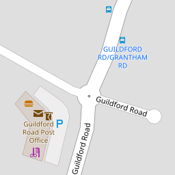
| Guildford Road, Southport, Merseyside, PR8 | £ 259,999 | BUY | 6 / 10 | 0.17 KM |
| Shaws Avenue, Birkdale, Southport | £ 180,000 | BUY | Unknown | 0.20 KM |
Nearby Properties
| Address | Price | Distance |
|---|---|---|
| 91 Shaws Road | £ 163,000 | 0.00 KM |
| 113 Shaws Road | £ 49,500 | 0.00 KM |
| 81 Shaws Road | £ 150,000 | 0.00 KM |
| 82 Shaws Road | £ 148,500 | 0.00 KM |
| 76 Shaws Road | £ 157,500 | 0.00 KM |